Maps
| Name | Description | Project | Project Type | Document Date | Town |
|---|---|---|---|---|---|
|
|
In delivering the preliminary FIRMs (Flood Insurance Rate Map), FEMA sectioned Dukes County into 68 'tiles'. This map is the index map showing the tile bounding area and corresponding index number for all the tiles within Dukes County. | Other | October 30, 2013 | Gosnold | |
|
|
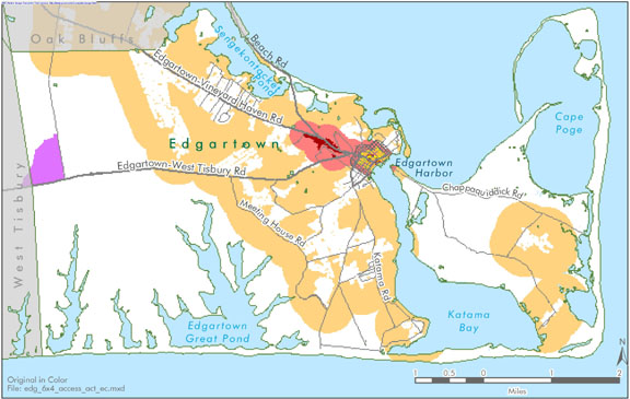
Edgartown map created for the economic suitability section of the Community Development Plan of 2004. | community development plan | Planning Project | October 23, 2006 | Edgartown |
|
|
Other | July 23, 2004 | All-Island | ||
|
|
Using various data sources (conservation land, wetlands, and assessor's data) the MVC compiled a dataset which identifies land on Martha's Vineyard as either fully developed, conserved, fully available, or partially available for development. Updated in 2014. | Other | September 17, 2014 | All-Island | |
|
|
Farm Pond water quality sampling stations for resource assessment during 2003 | mv coastal pond water quality survey- summer 2005 | Planning Project | June 22, 2007 | All-Island |
|
|
Road map of Oak Bluffs compiled in April 2012 using street data from Navteq 2011. All streets are labeled and an street name look-up table is provided with corresponding map index location. | Other | April 19, 2012 | Oak Bluffs | |
|
|
Water Resource Assessment Stations - Tashmoo Pond - for sampling year 2004 | Other | October 18, 2006 | Tisbury (Vineyard Haven) | |
|
|
The MVC and TNC worked together to classify the habitat function areas on Martha's Vineyard. The final classification identifies Critical Habitat areas, Intact Habitats, Connector Habitats, Disturbed Habitats, and Settled (i.e. human developed) Habitats. | Other | July 26, 2012 | All-Island | |
|
|
PDM Gosnold Wildland-urban Interface Map | Other | January 14, 2014 | Gosnold | |
|
|
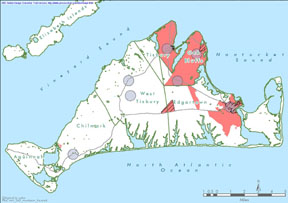
Island-wide map created for the housing section of the Community Development Plan of 2004. | community development plan | Planning Project | October 27, 2006 | All-Island |
|
|
DRI 582 - Vineyard House Site Plan 2005 | dri 582 - vineyard gardens site plan | DRI | June 10, 2005 | Tisbury (Vineyard Haven) |
|
|
DRI 613 Hoehn Bldg Locus Map | hoehn bldg | DRI | April 25, 2008 | Tisbury (Vineyard Haven) |
|
|
DRI 464-M Lagoon Ridge Subdiv Locus Map | lagoon ridge subdivision | DRI | June 24, 2011 | Oak Bluffs |
|
|
Edgartown map created for the 3 Open Space and Natural Resources section of the Community Development Plan of 2004. | community development plan | Planning Project | October 23, 2006 | Edgartown |
|
|
This map displays the DCPC (Districts of Critical Planning Concern) and other overlay zoning areas for Oak Bluffs, MA. Last updated on 11/7/14. Note: This version does NOT include the Water Resource Protection District. This data will be included in a future version of this map. | Other | November 7, 2014 | Oak Bluffs | |
|
|
Edgartown map created for the housing suitability section of the Community Development Plan of 2004. | community development plan | Planning Project | October 23, 2006 | Edgartown |
|
|
Color map - E size | Other | July 23, 2004 | Oak Bluffs | |
|
|
Color map - E size | Other | July 23, 2004 | Tisbury (Vineyard Haven) | |
|
|
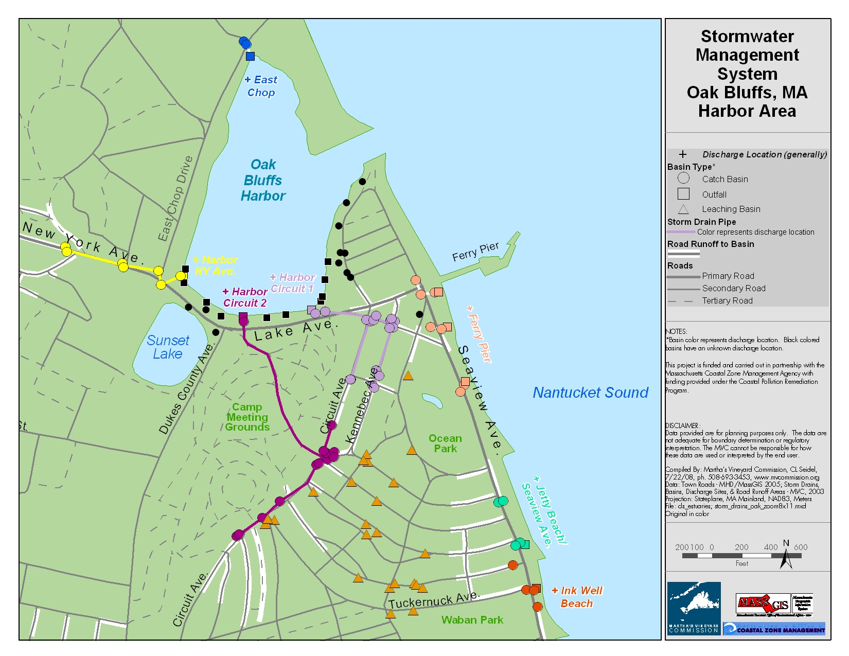
Catch basin locations were GPSed by the MVC. The general storm water pipeline system is also mapped. This map is formatted for an 8x11 page. | Planning Project | January 7, 2015 | Oak Bluffs | |
|
|
Sengekontacket Pond water quality sampling stations for resource assessment during 2005 | mv coastal pond water quality survey- summer 2005 | Planning Project | June 22, 2007 | Edgartown |
Pages
Office location:
Office location:
The Stone Building
33 New York Avenue
Oak Bluffs, MA 02557
Telephone: 508-693-3453
Fax: 508-693-7894
Mailing Address
Mailing address:
Martha's Vineyard Commission
P.O. Box 1447
Oak Bluffs, MA 02557
About the MVC
Site Map
Copyright
© 2008 - 2024
Martha's Vineyard Commission
All Rights Reserved